
Big Electric Forest Ride
Explore Ashclyst Forest; it’s electric!
Distance
22km or 25km
Start
- Grid ref:
- SX999954
- what3words:
- ///careless.warthog.energy
End
- Grid Ref:
- SX999954
- what3words:
- ///careless.warthog.energy
Confident cyclists could take on the whole route, otherwise the first leg from Cranbrook to Killerton and back is suitable for over 16’s accompanied by an adult. Treat yourself to lunch at the Stables café, Killerton, or take a picnic to have at Ashclyst Forest and treat yourself to a drink and cake at Killerton!
This route is not suitable for unsupervised children or less confident cyclists due to a 0.5 km section on the B3181 and the majority on lanes, which although generally quiet, do carry vehicles.
The outward leg starts at Cranbrook railway station. This leg is 11 km. The return leg is 14 km and takes in the hilly climb up to Caddihoe, Ashclyst Forest.
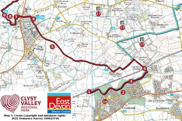
1. Cranbrook Railway Station - 1a. Younghayes Centre
2. Gem: Cranbrook Country Park is three beautiful meadows of diverse habitats - a wonderful place to relax and renew. Cranbrook Town Council
3. Tillhouse Farmhouse
4. Hazard: The road rises up to Crannaford Level Crossing so take care especially in the winter when the low sun can make visibility difficult for drivers coming the other way.
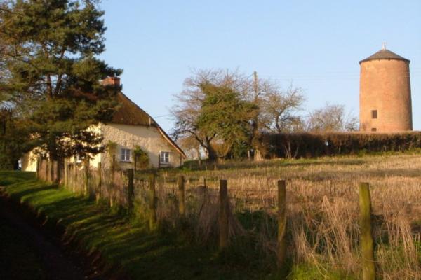
5. The Old Windmill in Dog Village was built in 1786 by the baker Sam Flood Historic England
6. Marker's Cottage is a 15th century cottage, named after Sarah Marker who lived here 200 years ago. Please note this is now a private residence.
7. St John the Baptist Church dates from the late 15th century although it was substantially restored in the Victorian era. Historic England
8. The National Trust have preserved Clyston Mill which dates to the late 18th century
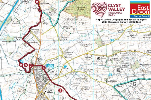
9. Killerton Broadclyst Family Cycle Trail, NT
10. Budlake old post box.
11. Gem: Killerton House, A family home and a great estate. Glorious landscape garden surrounded by parkland with fine 18th-century house.
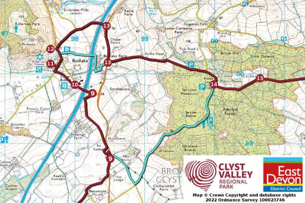
12. Killerton Chapel was built from volcanic rock from the Killerton estate in 1841.
13. Hazard: B3181 Take care on the busiest road on this route. (Walkers can take an alternative route past Budlake Farm)
14. Gem: Ashclyst Forest is the largest area of woodland in the Clyst Valley National Trust
14. Rewes Cross in the heart of Ashclyst Forest. Turn left to continue this route or carry straight on for a shorter route back to Broadclyst and Cranbrook
15. Caddihoe is late 17th century cottage nestled in an enchanted woodland Historic England
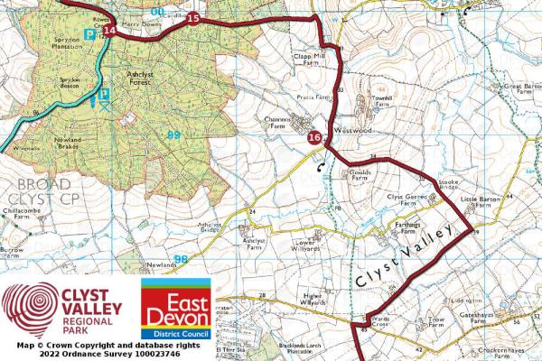
16. Church of St Paul, Westwood was buit in 1874 and is now a private house. Historic England
17. Three Solar Parks, Burrowton, Sandercroft and Cranbrook provide clean energy for homes and transport.
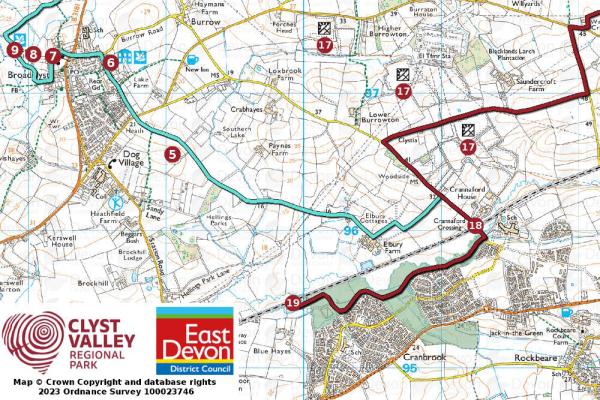
18. Hazard: Crannaford Level Crossing
19. Return through Cranbrook Country Park to Cranbrook Railway Station
Hourly trains to Cranbrook via South West Trains
Buses every 20 minutes from Exeter St Davids (Stagecoach Route 4)
Cranbrook Railway Station EX5 2DY
Cranbrook Railway Station EX5 2DY
At Younghayes Centre during office hours and at Killerton. Baby changing facilities. Wheelchair accessible.